Trail Notes September 10, 2026 16 min read
Dispersed Camping Near Lake George, CO
Dispersed camping near Lake George, Colorado is some of the closest free camping to Colorado Springs, and most people looking for it are looking in the wrong place. You cannot camp in the pullouts along Eleven Mile Canyon. You can camp, for free, on a ring of forest and BLM roads around the canyon, and

Dispersed camping near Lake George, Colorado is some of the closest free camping to Colorado Springs, and most people looking for it are looking in the wrong place. You cannot camp in the pullouts along Eleven Mile Canyon. You can camp, for free, on a ring of forest and BLM roads around the canyon, and the best of them is about twenty minutes past the canyon entrance and an hour and a half from the Springs.
We have camped out here more than once. This post covers where dispersed camping is actually allowed, how to get in without paying the canyon fee, the rules that get people ticketed, what the fire bans mean, and what a night at 8,500 feet is really like.
Can you dispersed camp in Eleven Mile Canyon?
No. Dispersed camping is prohibited inside the Eleven Mile Canyon Recreation Area. The Forest Service manages the canyon as a fee-based day-use and developed-campground corridor, and the pullouts along the South Platte are for fishing and picnicking, not overnight stays. [VERIFY: quote the exact prohibition line from the Forest Service Eleven Mile Canyon Recreation Area page and link it here.]
What the canyon does allow:
- Day use for a per-vehicle fee. At the time of writing it was $11 per day, or $100 for an annual pass.
- Developed campgrounds with reservations: Spillway, Riverside, and Springer Gulch, plus Blue Mountain near the entrance. More on those below.
- Fishing on one of the better stretches of the South Platte in the state.
- The drive itself: the old railroad grade, the rock tunnels, and the dam at the far end.
So if what you typed into Google was “Eleven Mile Canyon dispersed camping,” the honest answer is that it does not exist. The good news is that the roads immediately outside the canyon boundary do allow it, and they are better anyway.
Where dispersed camping near Lake George is actually allowed
Everything below is free, first come, first served, with no water, no toilets, and no trash service. Distances are rough driving distances from the Lake George gas station on US-24.

Forest Road 393 / Wagon Tongue Gulch Road (our pick)
This is where we camped, and it is the one nobody writes about. FR 393, signed as Wagon Tongue Gulch Road, climbs out of the canyon onto the high ground above it, and most of its length is BLM land rather than Forest Service. Sites are scattered along the entire road, some right off the main track and some down short spurs. From the canyon side, the turnoff is easy to find: the Wagon Tongue Gulch Road sign is shortly after the first tunnel on Eleven Mile Canyon Road, and our spot is about twenty minutes from the canyon entrance.
There are two ways in, and the choice matters:
| Route | Fee | Road | Best for |
|---|---|---|---|
| From Eleven Mile Canyon Road (County Road 96) | Yes. You pay the canyon day-use fee ($11 at time of writing) even though you are only passing through. | Paved then graded dirt to the turnoff, then dirt. | Anyone coming in from the Lake George side who wants the scenic drive and does not mind the fee. |
| The back way from US-24 past Florissant on County Road 46 | None. | Dirt county road, then FR 393. | Anyone who wants to skip the fee and does not need to see the canyon that day. |
The roads are all dirt, and they are not all equal. Over Labor Day weekend the main road was dry with a few deep, muddy puddles. It could use some grading, but it is far from the worst forest road we have taken in the Jeep, and we never needed four-wheel drive. High clearance is a different story: several spots want it, and some of the spurs off the main road would have been hard even for us. We watched SUVs and pickups make those spurs fine, and we watched a couple of vehicles turn around. A minivan or a low sedan will bottom out in places and should go slow, scout the rough sections on foot, and take the first decent pullout rather than pushing deeper.
One thing to know about the BLM part of the road: the rules are close to the Forest Service rules but not identical. The 14-day limit is the same. Setback from water and fire rules are set by the BLM Royal Gorge Field Office, so check that page rather than the Pike National Forest page if you are camping on FR 393.
- Distance from Lake George: About 20 minutes from the canyon entrance
- Surface: Dirt, dry with deep puddles after rain
- Vehicle: High clearance recommended; 4×4 only for the rougher spurs; minivan with caution
- Cell signal: One bar in certain spots, enough to check the weather when clouds roll in
- Best for: Solitude without a long drive
- Downside: The fee if you come in through the canyon; the road if you do not
Badger Flats (Forest Road 224 via County Road 31)
The closest and best-known free area, which is exactly its problem. From Lake George, take US-24 west about 6.5 miles, turn right on County Road 31 for 1.6 miles, then left onto Forest Road 224. Open meadow sites, easy for almost any vehicle, and full by Friday afternoon from June through Labor Day. If you arrive Friday at 6 pm in July, plan on it being taken.
- Distance: About 8 miles
- Surface: Graded dirt
- Vehicle: Any
- Best for: First-timers, big groups, trailers
- Downside: Crowds, and the meadow shows every fire ring and tire track
Matukat Road (County Road 77 / Forest Road 211)
Head north out of Lake George on County Road 77 toward Tarryall and the road climbs into rougher, more open country with views toward the Tarryall range. Sites are spread out along the forest road, and the farther you go the fewer neighbors you get.
- Distance: About 8 miles
- Surface: Dirt, rockier than Badger Flats
- Vehicle: High clearance recommended past the first few sites
- Best for: Views and quiet
- Downside: Exposed to afternoon storms
Forest Road 250 and Forest Road 275
Two shorter forest roads off the Lake George area with flat pullouts that suit camper vans and small trailers. Both are worth checking on the Motor Vehicle Use Map before you go, since the South Park Ranger District has been moving some areas to designated-site-only camping, which means you may only camp where a numbered post says you can. [VERIFY current designated-site status for FR 250 and FR 275]
- Distance: About 6 miles
- Surface: Graded dirt
- Vehicle: Any, with care on spurs
- Best for: Vans and small trailers
- Downside: Designated-site rules may limit where you can stop
Tarryall Creek and Tarryall Reservoir
Two different things that get confused. The pullouts along Tarryall Creek on County Road 77 are ordinary Pike National Forest dispersed sites and follow the normal rules. The campground at Tarryall Reservoir is a State Wildlife Area, and to camp there you need a valid Colorado hunting or fishing license, even if you never touch the water. [VERIFY SWA pass requirement on the CPW page] It is free with the license and rarely full.
- Distance: Creek sites about 6 miles; reservoir about 20 miles
- Surface: Paved to dirt
- Vehicle: Any
- Best for: Anglers, and anyone who already has a fishing license
- Downside: The reservoir is windy and treeless
North Round Mountain
Close to US-24 on the east side of Lake George, near the Round Mountain campground. Quieter than Badger Flats because it is less obvious, with a handful of tree-covered sites. Good if you want to be near the highway for an early start.
- Distance: About 6 miles
- Surface: Dirt
- Vehicle: Any
- Best for: A quick overnight on the way somewhere else
- Downside: Few sites, and you can hear the highway
Just outside the canyon boundary
There are a few informal areas near the canyon entrance and along the rim that people refer to by name: Fish Creek, Nice Camp, Great View, and Sledgehammer. [VERIFY these names and exact locations on the MVUM; several sources use them loosely] The thing to be precise about is where the fee boundary begins. If you are past the fee station, you are in the recreation area and cannot camp. If you are on a forest road that branches off before it, you are on ordinary Pike National Forest and the normal dispersed rules apply. When in doubt, the sign at the fee station is the line.
The rules that will get you ticketed (or asked to leave)
Dispersed camping rules in Colorado are simple, and rangers on the South Park and South Platte districts do patrol these roads on summer weekends. These are the ones that matter:
- 14 days, then move. The stay limit on Pike National Forest and on BLM land is 14 days in any 30-day period, and “move” means to a different area, not the next pullout.
- Stay back from water. The Forest Service standard is at least 100 feet from streams and lakes; some districts and many campers use 200 feet, which is what people mean by the “200 rule.” Camping right on Tarryall Creek is the most common ticket out here. [VERIFY setback distance for South Park RD and the BLM Royal Gorge FO]
- Use the spot that already exists. Camp on bare ground and existing fire rings. Do not clear a new site. Where you see numbered posts, camp only at those.
- Read the Motor Vehicle Use Map. The MVUM is the free Forest Service map showing which roads are open and how far off them you can drive to camp. On Pike National Forest that is generally 300 feet from a designated road, and only where the map shows a dispersed camping symbol. If the road is not on the map, you cannot drive it.
- Pack out everything, including toilet paper. Dig a cathole 6 to 8 inches deep, 200 feet from water, and carry out the paper. This is the rule most broken and most visible.
- No dumping grey water on the ground, and no washing dishes in the creek.
- Dogs under control. Leash rules vary; the practical rule is that your dog should never be out of sight.
- No cutting live trees for firewood, and no gathering wood at all during a fire ban.
How to read a Motor Vehicle Use Map in 60 seconds. Download the South Park Ranger District MVUM from the Pike-San Isabel site or in the Avenza app. Solid lines are open roads. Dashed lines are trails. A small tent-and-car symbol beside a road segment means dispersed camping with a vehicle is allowed along it. No symbol means you can still walk in and camp, but the vehicle stays on the road. Nothing on the map means nothing on the ground.
Fire bans and campfires around Lake George
Lake George sits almost exactly on the Park County and Teller County line, and the two counties do not always issue fire restrictions at the same time. It is normal for one side of US-24 to be under a Stage 1 ban while the other is not. The Forest Service and the BLM can each layer their own restrictions on top. Check all of them the morning you leave.
| Stage | What it means |
|---|---|
| Stage 1 | No campfires outside developed campgrounds with agency fire rings. Dispersed fires are out. Gas stoves and propane fire pits with a shutoff valve are fine. No smoking outside a vehicle or cleared area. |
| Stage 2 | No open flame anywhere, including developed campgrounds. Propane stoves with a shutoff usually remain allowed; charcoal and wood do not. Chainsaws and other spark sources are restricted. |
Our default is a propane fire pit, ban or no ban. It weighs a few pounds, it does not throw sparks into dry grass, and it means the trip does not change when the restrictions do. Links to check: the Park County Sheriff fire restrictions page, the Teller County Sheriff fire restrictions page, and the Pike-San Isabel alerts page.
When to go: seasons, weather, and elevation
These sites sit between roughly 8,000 and 9,500 feet. That number decides everything about the trip.
- April and May: Mud season. Forest road gates may still be closed and the open ones are soft. Do not be the ruts everyone else drives around all summer.
- June: Roads open, wildflowers start, and the crowds arrive on the first warm weekend. Nights still drop into the 30s.
- July: Warm days, afternoon thunderstorms almost daily by 2 pm, and lightning on the open ridges. Set up early, be in the trees by early afternoon.
- August: Monsoon. Wetter than July, more mud on the spurs, cooler nights. Fire bans often ease late in the month.
- September: The best month. Cool, dry, aspens turning by the end, half the crowd.
- October: First snow is normal. Nights in the teens. Roads still open until the county stops grading them.
- November to March: Possible, but the roads are not plowed and a storm can close your way out. Only with a vehicle and gear that can handle being stuck.
Even on Labor Day weekend our first night on FR 393 dipped into the low 50s, and July dawns at 8,500 feet regularly sit around 40. If you have never slept at altitude, read how to stay warm camping overnight before you go, and pack for the night rather than the afternoon. The same logic applies to the day: what to wear hiking at altitude covers the layers.
Arriving Friday and everything is full? The paid fallback
The Eleven Mile Canyon campgrounds and Eleven Mile State Park are the backup plan, and on a summer weekend they are usually reserved months out. Still worth checking for cancellations on the drive up.
| Campground | Book at | What it is like |
|---|---|---|
| Spillway | Recreation.gov | Far end of the canyon below the dam, on the river, the most requested |
| Riverside | Recreation.gov | Mid-canyon, on the water, small |
| Springer Gulch | Recreation.gov | Mid-canyon, up off the river, quieter |
| Blue Mountain | Recreation.gov | Near the canyon entrance, in the trees, not on the water |
| Happy Meadows | Recreation.gov | North of Lake George on the South Platte, outside the canyon fee area |
| Eleven Mile State Park | CPW (cpwshop.com) | On the reservoir, open and windy, hundreds of sites, needs a park pass |
What to bring for a night on the forest roads
There is nothing out here. That is the point, and it is also the packing list. Our full weekend camping packing list covers the details; these are the things that matter most on these specific roads.
- Water: All of it. A gallon per person per day, plus a filter if you plan to pull from Tarryall Creek.
- Waste: Trash bags, a trowel, a bag for used toilet paper, and a container for grey water.
- Fire: A propane fire pit or stove, and a way to check the ban status before you lose signal.
- Warmth: A bag rated well below what you think you need, a hat you can sleep in, and a hoodie for the morning. A camp hat is the single most-used thing we bring at this elevation.
- Navigation: The MVUM downloaded offline, and a paper backup. Cell coverage is patchy on every road above.
- Vehicle: A full-size spare, a shovel, and traction boards if you are taking anything low into the spurs.
Our night on Wagon Tongue Gulch Road
We went over Labor Day weekend 2026 with the family and both dogs, and some friends drove out Sunday afternoon to hang out and explore. We paid the canyon fee this time rather than taking the back way, for two reasons. We wanted to spend part of the weekend down in the canyon, in the water and fishing, and we got a late start on Saturday and wanted to reach our favorite spot before someone else did.
The road gave us no trouble. A few deep, muddy puddles, nothing that needed four-wheel drive. Some of the offshoots looked like they would have been difficult even in the Jeep. We saw several SUVs and trucks handle them without a problem, and we saw a couple of people turn around.
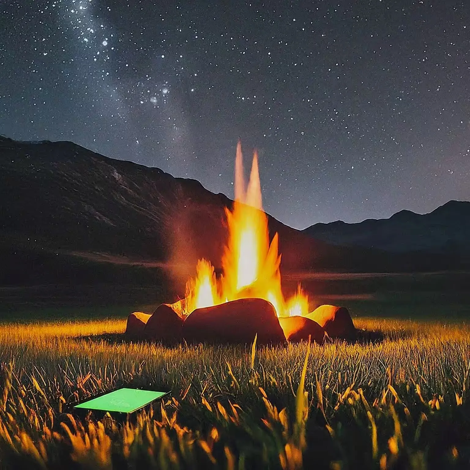
Our site sits just before a hill, backed up against a giant rock formation and a dry creek bed. You cannot drive right to it, so we carried the gear in about twenty yards, which was nothing. The nearest other camp was a quarter mile down the road and we never saw or heard them. Both nights were clear, and it was some of the best stargazing we have had in a year or two: the Milky Way was easy to pick out and we counted four or five shooting stars across the two nights. The first night dipped into the low 50s and we slept with the rain fly off to watch the sky. The second night we put the fly on, which kept everyone a bit warmer, and it was about perfect. Days got warm, into the mid 80s, but the canyon is close enough that a quick trip down to the water fixed that.
The honest downsides: the creek bed was dry, so there was no water for the dogs to drink or for anyone to poke around in, and the site has no trees for hammocks. Being tucked against the creek bed did keep us out of the sun for most of the day, but it also meant the sun took a while to reach camp in the morning, so it stayed cool longer than we might have liked. None of that changes the verdict. It is one of our favorite spots in Colorado, about an hour and a half from our house in Colorado Springs, which is exactly the right distance for a weekend, and it is the same kind of trip we wrote about in our weekend off the grid. We will be back.
Frequently asked questions
Can you camp in Eleven Mile Canyon?
Only in the developed campgrounds: Spillway, Riverside, Springer Gulch, and Blue Mountain, all by reservation. Dispersed camping is prohibited inside the recreation area. Free dispersed camping is available on forest and BLM roads outside the fee boundary.
Is dispersed camping free near Lake George?
Yes. Dispersed sites on Pike National Forest and BLM land around Lake George have no fee and no reservation. The exceptions are Tarryall Reservoir State Wildlife Area, which requires a hunting or fishing license, and any route that passes through the Eleven Mile Canyon fee station.
Do I need a 4×4?
Not for Badger Flats, North Round Mountain, or the first sites on most roads. For the spurs on FR 393 and the far end of Matukat Road, high clearance and four-wheel drive make the difference between a campsite and a tow.
Can I camp near Eleven Mile Reservoir?
Eleven Mile State Park has hundreds of reservable sites on the reservoir, including walk-in backcountry sites, and requires a state park pass. There is no free dispersed camping on the reservoir shoreline itself.
Can you swim in Eleven Mile Canyon?
Wading and swimming in the South Platte are allowed in the canyon, but the water is cold year round and the current below the dam can be strong. Swimming is prohibited in Eleven Mile Reservoir itself. [VERIFY reservoir swimming rule on the CPW page]
Is there cell service?
Patchy at best. On FR 393 we could find one bar in certain spots, enough to check the weather but not much more. Expect nothing in the drainages. Download maps and check fire restrictions before you leave Lake George.
Whichever road you pick, leave the site cleaner than you found it. Pack out the trash that was there before you, knock down the extra fire rings, and the pullout stays open for the next person. More place notes in Trail Notes, and the shirts that came out of nights like this one in the camping collection. If you have a pullout out here you are willing to share, send us a photo.