Trail Notes September 3, 2026 6 min read
Cottonwood Pass, Colorado
A paved Continental Divide crossing at 12,126 feet west of Buena Vista. When it is open, whether it is an easy drive, and why the summit is colder than you expect.
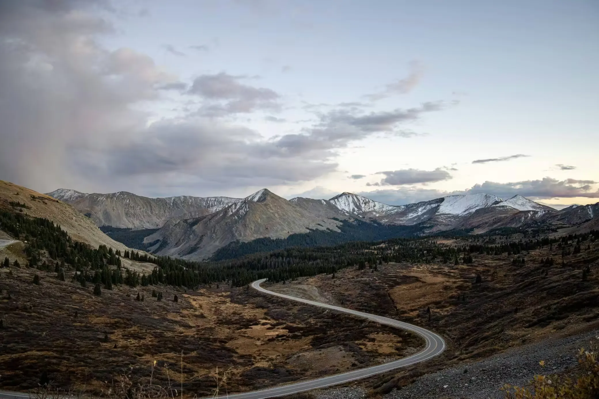
Cottonwood Pass crosses the Continental Divide at 12,126 feet, on the county line between Chaffee and Gunnison in the Sawatch Range. You reach it by driving west out of Buena Vista on County Road 306, climbing about twenty miles and four thousand feet to a summit parking lot with views down both sides of the Divide.
It is paved the whole way, it is closed in winter, and it is one of the few 12,000-foot passes in Colorado you can drive over in a normal car without thinking twice about it.
Is Cottonwood Pass paved?
Yes — both sides. This is the question people ask most, and the answer changed relatively recently, which is why older advice still says otherwise.
The eastern approach from Buena Vista has been paved for a long time. The western descent toward Taylor Park Reservoir was a dirt road for decades and was paved as part of a project completed in 2019. If you read a trip report describing washboard gravel on the way down to Taylor Park, it predates that work.
So a passenger car handles the whole route. There is no 4×4 requirement and no high-clearance requirement. What there is, is altitude: a long sustained climb with switchbacks near the top, and thinner air than most engines and most drivers are used to.
Is it an easy drive?
For a 12,000-foot pass, yes. The road is wide, fully paved and well graded, with guardrails on the exposed sections. It is not in the same category as the shelf roads people mean when they talk about Colorado’s frightening passes.
Two things do catch people out. The first is the switchbacks in the last few miles on the east side, which are tight enough to want second gear on the way up and engine braking on the way down. The second is weather: at this elevation an afternoon thunderstorm in July is routine and snow is possible in almost any month.
When it is open
Cottonwood Pass is a seasonal road. It closes for the winter and reopens in late spring once the snowpack has cleared, which typically puts the open season somewhere between late May and November.
Do not trust any specific date you read online, including ours. Opening and closing shift by weeks depending on the year’s snowpack, and closures happen mid-season after storms. Check CDOT’s travel conditions before you commit to the drive — that is the only source that is current.
The summit

There is a paved parking area at the top with vault toilets and interpretive signage, and it fills up on summer weekends. From the lot you can see west over Taylor Park and east back down the drainage toward Buena Vista and the Collegiate Peaks.
A short paved path runs from the parking area to a viewpoint — flat, accessible, a few minutes’ walk. The Continental Divide Trail crosses the pass here, so you can also pick up singletrack heading north or south along the ridge for as far as you feel like going. Both directions climb, and both give you more than the parking lot does within about half a mile.
One thing worth knowing: the Forest Service puts the summit at 12,126 feet and Wikipedia lists 12,119. The difference is survey methodology, not a dispute about which hill it is.
When to go
Late September is the reason a lot of people make this drive. The aspen stands on the eastern approach turn gold, and because the road climbs through several thousand feet of elevation you pass through different stages of the turn on a single ascent — still green low down, past peak up top.
Summer is busier and greener, with wildflowers through July and reliable afternoon storms. Early season, right after the road opens, you often get snowbanks still standing at the summit against green valleys below, which is the most striking version of the view and the one fewest people see.
We like to take the pass in late summer on the way to Crested Butte, CO to see the wild flowers and mountain bike. Last time we went was the middle of July and we hiked the first half of the Ptarmigan Lake trail.
What to wear at 12,126 feet
The summit runs dramatically colder than Buena Vista, and this is where people get caught out, because you can drive from a warm valley to an exposed ridge in under an hour without ever leaving your car.
As a working rule, expect to lose roughly 3 to 5°F for every thousand feet you climb. Buena Vista sits near 8,000 feet, so the summit is four thousand feet above town — call it fifteen to twenty degrees colder before you account for wind, and the summit is fully exposed with nothing to break it.
What that means in practice:
- Bring a layer you did not think you would need. A warm afternoon in town is a cold one at the top. This is the single most common mistake.
- Something windproof. Temperature is only half of it; the wind across the saddle does the rest.
- A hat, even in July. UV intensity climbs with elevation and there is no shade at the summit.
- Skip cotton if you plan to walk far. Fine for the viewpoint, less good if you are heading out on the CDT and might sweat then stop.
If you are staying in the car and stepping out for photographs, none of this is critical. If you are walking any distance from the lot, all of it is.
The other Cottonwood Pass
Worth clearing up, because it causes real confusion: Colorado has two roads called Cottonwood Pass.
The one described here is the paved Continental Divide crossing between Buena Vista and Taylor Park in the Sawatch Range. The other is in Eagle County, running between Gypsum and the Roaring Fork Valley. That one is a very different proposition — a rougher, unpaved county road used mostly as a back way around the I-70 corridor.
They are unrelated, roughly a hundred miles apart, and they open and close on separate schedules. If you are searching for road status, make sure the page you are reading is about the right one.
Making a day of it
The pass works as an out-and-back from Buena Vista in a couple of hours, but the better version keeps going. Descend west to Taylor Park Reservoir, and you can either loop north toward Taylor Canyon or continue on toward Crested Butte.
East of the pass, Buena Vista sits in the Arkansas Valley beneath the Collegiate Peaks, and the same day can take in the hot springs, the river, or the drive north toward Twin Lakes and Independence Pass — another Divide crossing about forty minutes up the valley.
The tee
We named a shirt after this pass, which is probably clear by now. The Cottonwood Pass tee came out of exactly the drive described above — the switchbacks, the gold on the lower slopes in late September, the granite above the tree line. It is printed on Airlume combed and ring-spun cotton, and like everything we make it is named for somewhere real rather than a generic mountain outline.
More place notes in Trail Notes, and the rest of the range in the tees.